I have a couple of the coolest photos and pics from Charleston. I know this site is normally about insurance but I decided to go into something that I find fascinating and that is the town I live in. I am a sucker for history and old records. I have a couple of old maps that are incredibly interesting. Keep in mind that Charleston is one of the oldest cities in the country so the history behind this town goes a lot further back than insurance.
 |
| Charleston's Trademark |
|
|
|
This is basically Charleston's signature image. When it was completed in '05, there was one of the best fireworks shows I've ever seen. It lasted for over 30 minutes and it was synchronized with music and it really hit Charleston with a bang.
 |
| Arthur Ravenel Bridge |
|
|
Here is another view of it.
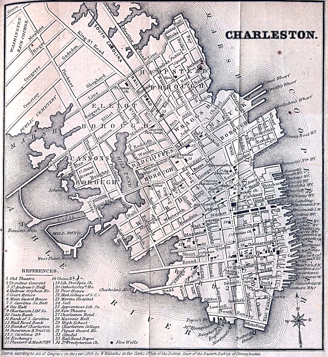 |
| Charleston Peninsula | | |
|
|
I had to blow this one up big so that you could see some of the streets. Keep in mind that the reason much of downtown floods is because it is originally marsh and wetlands. I love old historical photos and maps like this.
 |
| Charleston Peninsula 2 |
|
You might have to click on this one to see it well. Check out the location of the Citadel and now its over near what's labeled as the Washington Race Course. Does anyone know what this is or was?
 |
| Shem Creek |
This is the creek that winds up behind my house. It is a signature location for Mt Pleasant which is just east of Charleston. In fact, the bridge, pictured above connects Charleston to Mt Pleasant.
 | |
| Mt Pleasant |
This is a picture of the sunrise in my backyard on Shem Creek.
 |
| Alhambre Hall |
|
|
This is a park in Mt Pleasant that is stunning at sunset. In the distance you can see the bridge.
 |
| Old Mt Pleasant |
|
This is one of the only old maps I could find that actually said Mt Pleasant on it.
I normally stick to insurance but I thought this would be a neat post for a change. Let me know your comments and if you have any other cools maps to research. I love to discuss and find old records too so comment away.
No comments:
Post a Comment